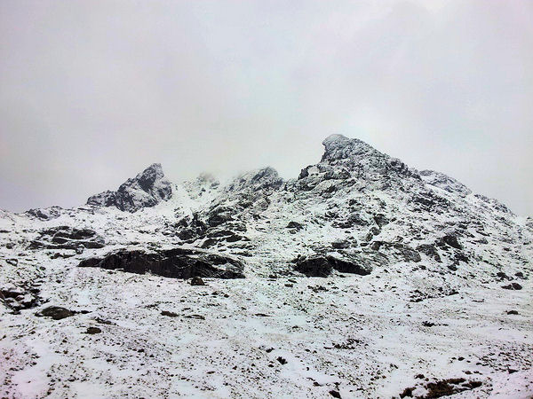
It was February last year when we last climbed Scafell Pike in conditions that can only be described as a whiteout. Shona had managed to get a few days off work for a return trip to the lakes again this year. I could see this turning into a sort of yearly tradition although it really should have been Snowdonia's turn this time.
The weather dictated our destination in the end, Wales was looking that little bit wetter than the Lakes. We made all our preparations on Sunday, then set off very early on Monday morning at around 5am. The plan this year was to go straight to Wasdale and climb Scafell Pike that morning, via the Brown Tongue ascent. Our previous route last year from Great Langdale had been fun, but we needed a change and a shorter route seemed much more appealing.
We parked in the car park next to the Wasdale Campsite, alongside the only other car there. The parking tickets are extortionate to say the least, about six or seven pound coins were fed into the machine. For a moment I thought I was paying for a multi-storey bay in Edinburgh city centre. Once kitted up and with the dogs eager to stretch their legs we strode off in the direction of Lingmell Gill.
Past a little holiday cottage and through a few gates, we were soon walking up along the path rising beside the stream. Showers of light rain had been spraying us on and off, so we were pleased when at last the sun appeared through the greyish clouds and began to heat up the valley.
As we gained altitude, the terrain gradually became more rocky and soon we were veering northeast out of Brown Tongue, following the path as it came and went over the rises. At around 700m the trail now mostly covered by snow turned east then south to climb up the northwest shoulder of Scafell Pike.
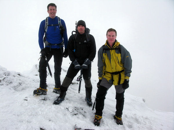
We stopped at around 800m to put on crampons. With the ground ahead getting steep and the snow turning to ice, this made our progress much easier. At pretty much the same time we became immersed in cloud, the terrain began to flatten out and the winds whipped across us from the east as we hit the last stretch of trail across the short summit plateau. In no time the little rise with trig-point and huge cairn came into view.
Although shrouded in cloud we were still rewarded with better visibility than the same time last year when we found ourselves in the same vicinity amidst blizzard conditions. We took a few pics and grabbed a quick snack before heading back more or less the way we had ascended.
We found it so easy descending in our crampons that we left them on until we were at the point where the Corridor route meets the track back to Brown Tongue. During our descent we met quite a few people making their way up the route we had taken. Everyone was keen to find out how bad conditions were nearer the summit. Fortunately we were able to reassure them that there were no real worries other than the icy winds.
Just like the way up, the transition from Brown Tongue into Brackenclose via Lingmell Gill was like walking into a different place and climate. We walked off the snowline and into a sun filled valley, skipping down the rocky path towards Wastwater. Very soon we were back at the car and planning where we would set up camp.
We decided to attempt to cross the Hardknott pass and camp at the National Trust camping ground in Langdale. Shona did the driving and coped admirably. I don't think we would try to go up over the pass in those conditions again, unless we had a Defender 4x4.
Making it to the campsite safely was a relief, and we pitched the tent on a nice little raised area alongside a few other small tents nestling in the snow, then ended up in the bar of the nearby Old Dungeon Ghyll Hotel for a well earned beer or two.
The next day, we decided to have a break from the hills and instead had a good nosey around the outdoor shops of Ambleside and Bowness. Many of the shops are dog friendly, a few are not. In a way it's quite good to wait outside with them as one of us has a look at the gear on offer. If we were both browsing together I'm sure there would be more stuff bought that we didn't really need!
We decided on our final day to climb up Helvellyn. No fancy route via Striding Edge due to our location and lack of time to drive the long way round. Instead we parked near the southern edge of Thirlmere to take the Comb Crag route which allowed us to include Nethermost Pike on our way back down.
There were quite a few people headed up from this location. After buying a parking ticket then losing it down the front of the dashboard I duly refilled the machine with another handful of pound coins. With empty pockets we started up through some woods to the path leading up to Comb Gill and then the crags.
Once past High Crag the snow lying on the ground got much thicker and harder. We continued north inside cloud with occasional blasts of snow moving from east to west across our path. It was as we neared the memorial where Striding Edge joins the main ridge that we noticed a small family group who appeared ill prepared for such a hike. It looked like Grandpa and 3 youngsters, the oldest girl (around 13ish) was wearing leggings and trainers without any socks. Her outer layer was a thin runners cagoule.


I was so shocked at this particular girls attire that I can't really recall what the other two younger children were wearing. I just know that none had any suitable gear to be hiking on the hill that day. We continued onwards to Helvellyn's summit and got a few snaps with the dogs before making our retreat back down the ridge. It wasn't long before we had caught up with the youngsters who were now being forced to run down hill by their Grandpa who was way too far out in front to see his grandson falling over on the icy rocks which formed steps down to Comb Crag.

We slowed our pace as we moved towards lower ground and the woods leading back to the carpark. It meant that we could make sure that kids got down safely in front of us. At a path just before the parking area they moved off south which was just as well for Grandpa, as I don't think I could have walked past him without giving him a few choice words. We got back to the car and quickly got the engine running and the heaters blasting. After a little drive through Keswick, but deciding not to stop we were soon on the motorway heading north to Bonnie Scotland, where you don't even get halfway up a hill in a cagoule, well not in February anyway!

I had last been up at the Cobbler with the dogs about a month ago, then there was quite alot of snow on the higher areas. Today there was alot more of the white stuff and our group from the GWHC were heading up for an enjoyable hike in winter conditions. I was first to arrive at the Succoth car park, meaning I had plenty of time to get my kit in order before we set off. Alfie also got to have a wee nosey around before being trussed up in his dog coat and harness. Gradually everyone arrived and got geared up, a few new faces for this one too, The Cobbler is always a popular walk.


So yeah, we waited for the rest to catch up and then blisteringly sped off up the path beside the Allt a' Bhalachain. Just after the Narnain Boulders we grouped up again as several of us were going to cut off the path and ascend the western gully. At this point we stepped into our crampons and began to climb up the iced over stream that marked out the route. I was interested to see how Alfie would cope on steeper terrain in these conditions and thus far he appeared to have had no problem using his claws as crampons.


The other section of the group chose to walk up the main path to just beyond the Lochan a' Chlaidheimh, there they would then take the southerly staircase route up to the south peak. For us up at the col, the route would take us up onto the north peak first before we retraced our spike marks back down to the col and then up onto the south peak (884m). A few of the other section had broken off to do Beinn Ime instead of the Cobbler, but we met the rest on the south peak before everyone moved back down to the col to have a quick bite to eat.


After refuelling we started down the staircase route to the cross paths at the Lochan. Most of the group were going to head on down the path back to the car park, but myself, Barry, Kenny and Stewart decided that Beinn Narnain was looking too inviting to resist. We moved north at first before heading east up the shoulder of Narnain. It got much colder as we neared the summit (926m). My insulated platypus tube froze, which it hadn't done on the Cobbler, so even that few extra metres in altitude can make alot of difference.


We didn't hang around for long on the top, heading quickly southeast towards the Spearhead. It was here at the gully where we really had to utilise our axes to the max. After watching Barry, Kenny and Stewart having to axe arrest at several places, I decided to turn face-in and down-climb the gully using my axe in a technical fashion. All worked out well, except that Alfie was stuck at the top of the Spearhead refusing to budge. I had to climb back up and tie his lead onto my pack's belt. He then grudgingly moved down the gully with me coaxing him in between axe placements. Kenny was anchored down below and watching to make a catch if need be, but thankfully Alfie stayed attached to me and we got down safely.

From there we trotted along the ridge to Cruach nam Miseag and then down to Creag an Fhithich before we broke into the forested area that took us back down towards the main road. We lost Stewart for a bit in the forest, maybe he needed some quiet time? but he soon popped out farther along the track as we joined the wide path back to Succoth.
The rest of the days hikers had dispersed with some opting for a drink at Ben Arthur's Bothy. Barry and I headed round there and managed to catch a few of them before they hurried back to the big smoke.
Some photographs courtesy of spritely paced GWHC members.
Pronunciation/Translation: Geal Charn - gyal kaarn (white hill).
Yes, there's quite a few Geal Charns... The one we were tackling this day was the Monadhliath offering. This was a GWHC meeting and we had driven up in Grant's car the night before, and stayed at the Pottery Bunkhouse near Laggan Bridge. (Note to self, if sharing a dorm with Grant and Barry again... bring earplugs to combat excessive snoring!)
Seven of us were making this climb. Once everyone had made the rendezvous at the start point we set off across General Wade's Garva Bridge and onto a track which took us through the first part of the route. Following the east bank of the Feith Talagain we moved through farmland until we started reaching higher ground near the Allt Coire nan Dearcag. A little upstream we managed to make it across the narrow but fiercely flowing stream.
From here it was a case of heading up onto the southwest shoulder of Geal Charn and just slogging it over increasingly rocky terrain to the wide summit (926m). To the east of the summit was some steep craggy cliffs leading down to the Laggan Choire. We moved south off the broad summit towards the bealach leading to subsidiary peak Beinn Sgiath.
After Barry had practiced some ice axe arrests above the col, we settled down for a bite to eat. Some darker snow clouds had begun to move in our direction, so we moved on quickly striding up and over Beinn Sgiath and then down over boggy ground towards a lower rising rib that lead to Meall an Domhnaich which on it's southwestern side would lead us steeply down through a band of larch wood to the Garva Bridge again.
We tentatively moved through the larch trees using trunks to slow down our momentum as we made our way lower to the bridge. Very soon we were back at the cars and planning a post-hike pint in Pitlochry.
A good hike in fresh conditions made an unremarkable munro a bit more interesting. Certainly a hill better visited in winter conditions.
Some photographs courtesy of GWHC members.