Wednesday, 31 August 2011

Creise, Glen Etive - 27th June 2011

Pronunciation/Translation: Creise - kraysh (unknown), Meall a' Bhuiridh - mowl a vooree (hill of the rutting stags)

(Entry by Shona)

We left Eric's house and headed for Glen Etive. Pitched our tent and enjoyed a nice meal while we watched the dogs, "Alfie and Bracken" run around.


On Monday we decided to hike up Creise. We got our gear sorted and took a wander along the River Etive to find a place to cross. The water levels were pretty high, so we headed further downstream, but could still not find anywhere safe to cross.

Back at the tent we studied the map and found there was a bridge a short drive down the Glen. We took the car along, parked up near the bridge and started our hike around 1pm.


The going was pretty tough to start with, through long, rough grass and very steep hillside. I didn't feel too peachy, but wanted to push on as the midges were horrendous. Eric and I decided to play the FNG (Famous Name Game) which took my mind away from feeling unwell.


We made the summit of Beinn Mhic Chasgaig at 864m but had to descend 165m to join the bealach which connected us with the ridge up to Creise and it's 1100m summit.


After a lot of whining from me, we eventually made it to the summit and decided to continue north towards the end of the ridge at Stob a' Ghlais Choire. We took in some nice views of Buachaille Etive Mor then headed back past the summit cairn of Creise and towards the head of Mam Coire Easain where we made a steep drop onto the ridge which took us up the western side of Meall a' Bhuirdh.
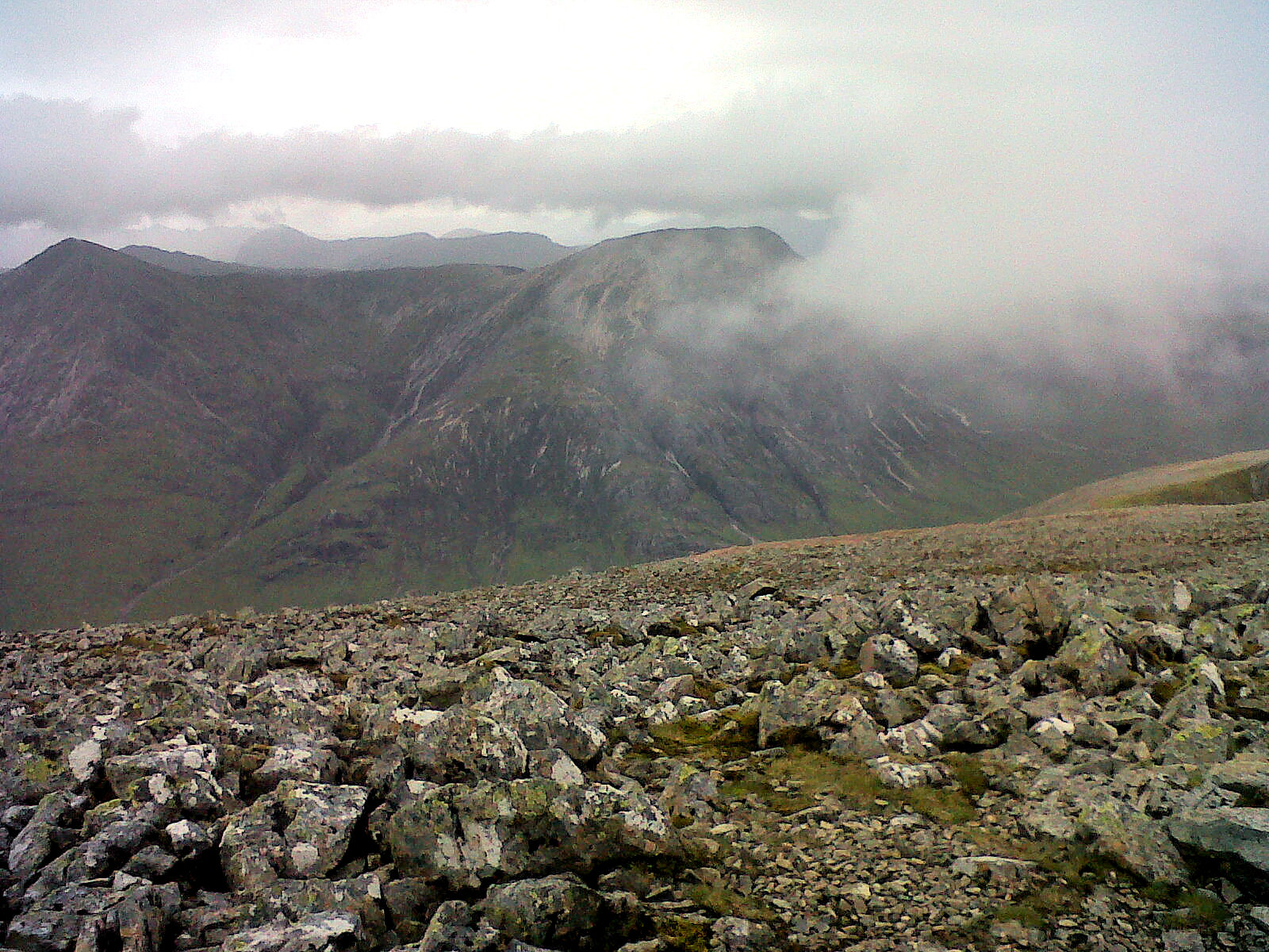


Several shots of Stob Dearg (Buachaille Etive Mor) from the Creise Ridge.

After this hard push to the summit at 1108m we were rewarded with excellent views across Rannoch Moor and Loch Tulla to the south. (It is on this peak that the weather readings are taken for the snow forecast information provided at the top right of our blog.) We took a short rest on the summit before heading back down the ridge linking the two Munros. We needed another rest at the top of the step back onto the main backbone of Creise, and as we replenished some liquids the clouds began to close in around us.


Clach Leathad with Stob a' Choire Odhair beyond.

Clach Leathad with Stob Ghabhar behind.

View to Loch Tulla from Meall a' Bhuiridh.

A very tiny Kings House Hotel from Meall a' Bhuiridh.

Stob a' Ghlais Choire, Stob Dearg (Buachaille) and Ben Nevis top right.

Looking out on the Rannoch Moor.

Step onto Creise Ridge from Meall a' Bhuiridh.

 Bracken and I have a rest, Alfie remains on guard duty.

 Coire an Easain.


We trudged onwards, heading west to the bealach on the north side of the Coire Odhar. Here we decided to drop down into the coire and join the north bank of the Allt Coire Odhair. The map states there is a footbridge crossing the river then a path down the valley to Glen Etive. The going was pretty steep but stable enough and we descended at a gentle pace.

I was lagging behind a bit and accidentally triggered a small rock fall, which sent a football sized rock hurtling towards Bracken. She sized it up, contemplated catching it in her mouth. Eric shouted out for her to move and I watched as with a second to spare she ducked and the rock hit Alfie square on the rump a few metres down the slope. With a slight look of surprise on his face he moved to Eric for some reassurance. Thankfully he seemed ok and we kept on moving towards the river.

Time pushed on and it was early evening as we reached the river. There was no footbridge, so we crossed using a tricky route of large boulders and stones. The path was visible but very wet and uneven. I picked out points of reference to keep me moving, I could barely lift my legs as I follow Eric and the dogs.

The path didn't seem to be descending as the river dropped far below us which was disheartening. Eventually the trail began to drop and we were nearly level with the river once more. It was here that the trail began circling round to the south, but we wanted to be heading west. I thought I could see a gap in the deer fence so shouted for Eric to wait. After checking the map again we see that there should be a river crossing near by, but we had to be on the other side of the deer fence. I headed for the fence, only to find that there was wire where I thought a gap existed. Eric shouted that there was a gate further back along the trail, so I had to trudge through waist high ferns to reach it.

We crossed the river again and were back on the trail. After what felt like an eternity the little cottages near the road came into view. Another 30mins of walking over very wet ground and we were back at the car, wolfing down crisps faster than I should, I ended up feeling rather ill. We made it back to the tent and gave the dogs an extra big feed. We then decided to lie down and chill for a bit to let our muscles recover from 8hrs solid hiking. It was hard work, but good for the soul. I felt tired but great, before falling into a deep sleep.

Tuesday, 23 August 2011

Climbing at The Whangie and Neilston Quarry - June 2011

While the weather was good we decided to take a trip up beyond Milngavie to do some climbing on the Whangie. It's a 30-40 minute trudge from the car park to the crags. Once there the climbing is quite limited and not a good place to climb if you like to place alot of protection.


Somewhere closer to home where the protection is more plentiful is Neilston Quarry. This is a great little stretch of crags for both trad climbing beginers and those looking to get their hands on real rock away from the indoor walls. The recorded routes are up to around 6a in difficulty, but by varying these routes and traversing the walls you can make it as difficult or as easy as you require.


Monday, 22 August 2011

The North Cuillins, Isle of Skye - 1st and 2nd June 2011

Pronunciation/Translation: Bruach na Frithe - brooach na freea (slope of the deer forest), Am Basteir - am bastar (meaning obscure), Sgurr nan Gillean - skoor nan geelyan (peak of the young men)
 

It was a special time of year again, Last year we spent most of Shona's "birthday week" up in the Cuillins of Skye. This year we had planned to visit Arran and do some climbing around the A'Chir Ridge. The only problem with going to Arran would be that we'd be depending on good weather, as taking the car on the ferry is costly to say the least.

Sadly the weather was not going to play ball. Winds were tearing down trees and the rain just didn't give up over the weekend. With Arran ruled out, we decided that regardless of the rain we'd take the road north to Skye again, with an overnight stop on the way in Glen Etive.

We camped at our usual spot beside the River Etive and Shona christened her new stove, cooking up a hearty meal of sausages and noodles. Also getting it's first use was her new Mountain Hardwear sleeping bag, which she reported later as having been suitably toasty.
Tuesday night was exceptionally wet, I don't think it stopped raining all night. When we peered out of the tent on Wednesday morning we were both shocked at the level of the river right next to where we had pitched. Raging torrents of water swept past us only 3 metres away.


We contemplated returning to Glasgow, but thought "what the heck" and continued onwards to Skye. First stop was at Portree. Shona was on the look out for a nice piece of antler she had seen last year in a shop window, unfortunately the shop in question appeared to have changed hands and was now selling outdoor clothing, oh err! Some obligatory fish and chips were purchased down by the harbour instead, and we drove back to the campsite by the Sligachan Hotel.

Not many tents were utilising the site. The warden told us that several had been taken out to sea the previous day by the gale force winds...  not very reassuring. It was a struggle to pitch, but once up, our tent seemed to cope admirably with the fierce southerly gusts. Just in case, we parked the car as close as possible to shelter it, then took refuge in the Hotel for some refreshments.

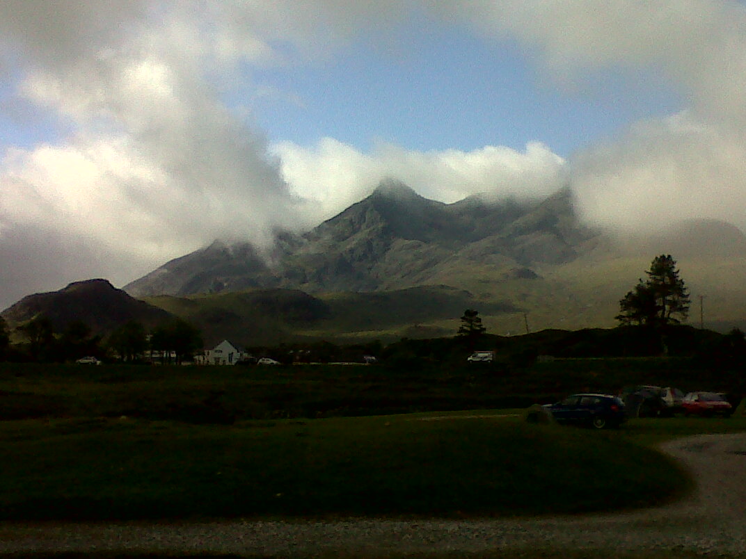
Another very windy night of camping was had. Aided by the soundtrack outside, I think at one point I dreamt I was camped on Everest's South Col. Fortunately the rain had decided to ease and by the time morning came the sun was doing it's best to peer through the clouds. We knew from our trip to Skye last year that on the Cuillins the weather conditions really do make much more of a difference. The day was brightening up fast and by the time we had packed up all our camping gear the three peaks of Sgurr nan Gillean, Am Basteir and Bruach na Frithe were now in clear view, beckoning us to take a closer look.


We parked at the Sligachan Hotel car park and crossed the A863 onto a boggy track which took us towards the Alt Dearg Beag. The track follows the north side of the stream for a while before allowing an easy crossing over a well made wooden footbridge.
The track continues south to Coire Riabhach, but as we reached the protruding slopes of the ridge which walls up Coire a Bhasteir we moved southwest onto higher ground and started climbing up towards the Knight's Peak and Pinnacle Ridge.


The ascent from around 550m to 700m beneath Pinnacle Ridge was the toughest part of the route. Several steep gullies cut down from the jagged ridge above and every turn provides challenging terrain of scree, boulders and difficult gully crossings. There is a more defined path which connects the Coire a Bhasteir to the Bealach a Bhasteir, but we had chosen to climb up to the base of the Pinnacle Ridge further east, moving onto West Ridge just below Sgurr nan Gillean. 


Once upon the West Ridge it's a good idea to find somewhere comfortable to sit and await the summit traffic jams to clear. To summit Am Basteir it's best to let anyone already on the top to get back to the bealach as it's strictly a single track ascent. Much more challenging is the summit of Sgurr nan Gillean which many climbers prefer to do safely with ropes, harness and helmet. On the west side of the Am Basteir summit there is quite a few tricky down climbs to gain access to Bruach na Frithe. We decided to give these a miss as we had the dogs with us.


After enjoying a quick bite to eat back on the West Ridge we got ready to head back down into the Coire a Bhasteir, this time using the track. Two gents trudged past us on the ridge towards Sgurr nan Gillean, both had their gaiters on back to front, which was a bit worrying! The track quickly took us down to the base of the coire. We decided to skirt across the top of the Alt Dearg Beag to the east and retrace our steps in reverse from our earlier ascent.


We made it back to Sligachan in good time and dogs seemed pleased to curl up in the back seat of the car as we set off on our long journey southbound on the mainland.


Wednesday, 22 June 2011

Bidean nam Bian, Glen Coe - 2nd May 2011

Pronunciation/Translation: Stob Coire nan Lochan - stop kora nan lockyn (peak of the corrie of lochs), Bidean nam Bian - beetyan nam beeoan (peak of the mountains), Stob Coire Sgreamhach - stop kora skree-yach (peak of the fearful corrie)


We had spent the night camped at Drochaid Tolaghan on the western shores of Loch Tulla. Arriving after our post-hike meal at Paddy's in Tyndrum, we had quickly pitched our tent with only headtorch lighting. Midge conditions were good for the time of year, but be warned this area rates as one of the worst for extremely high populations of midges during July and August. I recall last year having to swat the most amount of tent invaders ever while camped at the same location.

Early morning sunshine meant another great day for hitting the mountains was on the cards. We made our way up over Rannoch Moor to Glen Coe. Starting from the main parking area overlooking the Three Sisters, we headed down to the bridge crossing over the River Coe. From here we decided to set a spritely pace up the Coire nan Lochan. A fairly straightforward path zig zags it's way up the gully to the waterfall below the Stob Coire nan Lochan Buttresses.


The Aonach Eagach Ridge from Aonach Dubh.


Clachaig Gully (left) from Aonach Dubh.


Glen Coe Village from Stob Coire nan Lochan ridge.


Once upon the plateau we stopped for a short snacking session. The next part of this route is my favourite. Taking the northern shoulder that runs from Aonach Dubh up the ridge towards the Stob Coire nan Lochan summit, each new view is breathtaking. As you near the summit you begin to veer south and there is some scrambling to be done over large boulders until you reach the top.


Bidean nam Bian peering from behind Stob Coire nan Lochan's north ridge.


Pinnacle Buttress.


Pinnacle Buttress.


From here, the summit of Bidean nam Bian looks invitingly near, but there is still quite some legwork to be done. We followed the path south off Stob Coire nan Lochan down to the ridge at Collie's Pinnacle. Some steep scrambling here is again required to gain the summit of Bidean nam Bian which is a little less spacious than it's neighbouring summit.


360degrees from Stob Coire nan Lochan summit.


Stob Coire Sgreamhach, Bidean nam Bian and Stob Coire nan Lochan from Stob Dubh.


We descended back down to the ridge, it was our plan to take the steep route off the ridge into the lost valley (Coire Gabhail). An earlier plan to take in the summit of Stob Coire Sgreamhach was scrapped as we had noticed that Bracken our new Springer Spaniel was finding the going a bit grazing on her paws.

Path down towards lost valley.


We were soon onto the main path that runs along the lost valley. The valley floor widens out further down to an unusual glacial flood plain. It is said that in the days of the Highland clans, The massacred MacDonald clan once grazed their stolen cattle on this area of ground. At the northern end of the valley the path drops steeply down to Glen Coe. This area is full of cascading waterfalls, plunge pools and mixed woodland.

We made our way across the River Coe once again a little further up it's flow this time, and headed back across the Coe valley to the start/finish point of our walk.

After our walk we were pleased to find our camping spot down in Glen Etive was free and waiting for us. The dogs enjoyed a cooling swim in the river and Shona and I were sound asleep before it was fully dark.

Tuesday, 21 June 2011

Beinn Ime, Arrochar - 1st May 2011

Pronunciation/Translation: Beinn Ime - byn eem (butter hill)

This was the first Munro that Alfie my Springer did last year when he was just on the turn of pup to young dog. On that occasion we took the route up between the Cobbler (Ben Arthur) and Beinn Narnain.

This time we tackled it from the western side with Shona bringing Bracken along for her 3rd K9 Munro-bag. Beinn Ime is the tallest peak among the Arrochar Alps, and ascending from the west is a relatively short route. It is however a very steep trek up constant grassy slopes.

Starting from the Butterbridge car park in Glen Kinglas we headed into the glen then veered right onto the hill and steadily upwards towards the Glas Bhealach between Beinn Chorranach and Beinn Ime. Two gullies cut down from the Bhealach and in my opinion it's best to stay on the left of both during the ascent. A pair of hikers ahead of us attempted to go up over to the right of these gullies and seemed to find the terrain much steeper and slower.

A mixture of spongy moss and springy heather in places made this route quite tiresome on the thighs. Such slopes always seem to look far tamer from below, where the eye automatically assumes that the greenery is close cropped. It comes as some relief to make it to the Glas Bhealach. The ground underfoot is much firmer and you now feel like you're progressing towards the summit of Ime. It's now just a case of climbing due south to the summit. There are a few visible tracks that can be taken, but you really can't go wrong as long as you keep the apex of the route as your target.


On this occasion the weather could not have been better and once on the summit, views in all directions were stunning. There is a very elaborate summit cairn on Beinn Ime, almost like a little turret which can be used to shelter from the wind. Today the wind was whipping in from the east, so Shona and I took to the western outside wall of the cairn to grab our lunch. We chatted with the hikers who had been ahead of us on the right side of the gullies on their ascent. I think they had been surprised that we had reached the summit cairn a good 10 minutes before them. Another group arrived on the summit from the southern approach, so we got our packs back on and headed back down to the Glas Bhealach.


We were pondering the possibilities of crossing over to Ben Vane to the east. Instead we decided to drop east into the Gleann Uaine for a pleasant longer walk off the mountain. Heading north we arrived at a controlled mixed forest plantation skirting the top of Glen Kinglas. Ironically the deer fencing set up to prevent red deer from stripping the young trees had in fact trapped a large group of deer inside the plantation.

From here we stepped onto the estate dirt track and followed it leisurely back down to the junction on the A83.

Being a Sunday before a Bank Holiday Monday, the Drover's Inn was packed out. No seating available, so we boosted on up to Tyndrum to get to Paddy's Grill before they stopped serving food for the night. Paddy's in Tyndrum is great. Good pub grub with big portions and no fuss. Well behaved dogs are allowed in the bar too, which is a necessity for us.

Tuesday, 10 May 2011

Unexplored routes in Arctic Norway

I've just been confirmed as a team member for Gore-Tex's Expedition to northern Norway with climbing legend Dave MacLeod.

A shortlist of candidates were chosen to attend a final selection process with Dave.

We then go on the adventure of a lifetime with Dave and Paul Diffley of Hot Aches film productions to Tromso in Norway.

The expedition should take place in August 2011 and will cover 15 days of exploring and hopefully successfully climbing a batch of new unclimbed routes in the areas surrounding Tromso and it's numerous islands and peninsulas.

Thankyou to everyone who helped get me on the team, I really do appreciate your support, Eric.

Thursday, 5 May 2011

Skiing Everest

  Just added another great Snagfilms documentary to the right-hand column of this page.

I'm not a huge fan of skiing, probably because I'm not that great at it, but watching this film has inspired me to perhaps try and improve on my skills for next winter. For sure, I won't be attempting to ski from 8,000m. If I'm lucky I might manage from 800m.

So... go put the kettle on, set aside an hour and a half, put your feet up and indulge in this, an alternative method of descending the summits.  >>>