Thursday 29 December 2011

The South Glen Shiel Ridge - 10th August 2011

Pronunciation/Translation: Creag a' Mhaim - crayk a vaim (rock of the large round hill), Druim Shionnach - drim heenach (ridge of the fox), Aonach air Chrith - oenach ayr chree (trembling hill), Maol Chinn-dearg - moel chan dyerack (bald red hill), Sgurr an Doire Leathain - skoor an dira lehan (peak of the broad thicket), Sgurr an Lochain - skoor an lochan (peak of the little loch), Creag nan Damh - crayk nan dav (rock of the stags).


I had planned to walk this ridge early last year when there was still a lot of snow on the ground. I had to change my plans, because it was around this time in my life that young Alfie came about and demanded priority attention. Every time I pass through Kintail I gaze up and mutter that we really need to get that ridge done.

The main problem with doing the South Glen Sheil Ridge is the logistics of using one car between the start and end points of the hike. When I heard that the GWHC were planning on doing the route again, I got excited as car logistics would be easily sorted out.

Most of the others who had signed up to do the ridge were staying overnight at the Kintail Lodge's bunkhouse. Shona and I (plus dogs) planned to camp at the Shiel Bridge Campsite. We set off early evening on Tuesday 9th. During a pitstop at the Green Welly Stop we bumped into Barry who had been co-ordinating the meetup, sadly he had decided to pull out of this one as he'd been feeling unwell.

When we arrived at the Shiel Bridge site the weather was quite amiable, meaning that the midges were out in full force. Pitching was done as quickly as possible in order to limit the number of red dots appearing on uncovered skin. We decided to take the dogs for a walk up the path which connects the campsite to the Allt a Choire Chaoll. At least at a steady pace the midges would find it difficult to keep up with us. After a few miles, with the light beginning to fade we turned back to cook up some fine campsite cuisine before retiring to our sleeping bags.

Next morning we quickly got our things organised for the walk and headed round to the Kintail Lodge to meet up with the rest of the group. Unfortunately the rain that had been forecast had come early and had been falling steadily throughout the night. This was going to be a really wet day on the hills. After working out who would leave their cars where, we formed a convoy and drove to the start point at the Cluanie Inn.


Udo skipping past the Cluanie Inn's posh entrance


Hazy view down to Loch Cluanie
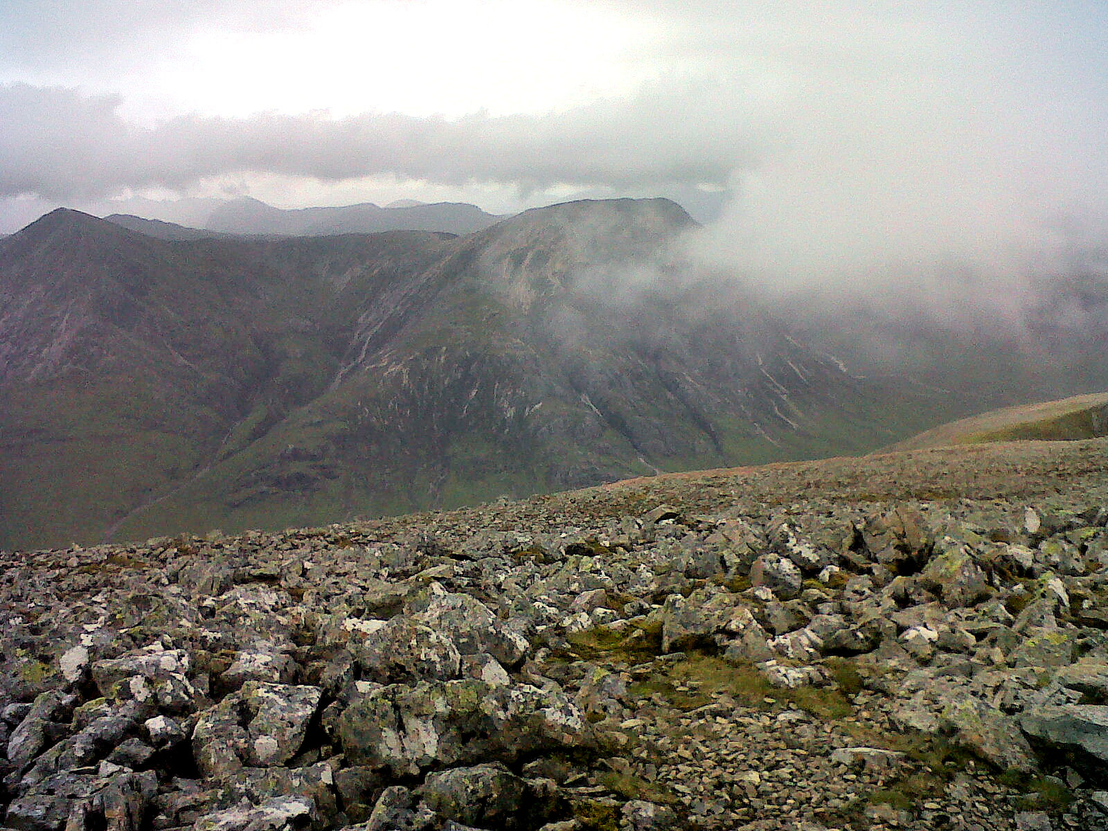

Long walk in


With waterproofs on and hoods up from the start we set off along the dirt road towards Cluanie Lodge. The track initially headed east then at the lodge, began to rise and veer southwards. After crossing a couple of tributaries of the Allt Ghiubhais the track made  a right angle turn east again and it was here that we broke off and made our way over a large stile and onto a very wet, heathery hillside.


The constant precipitation had taken it's toll underfoot. The narrow stalkers path up the hillside had been turned into what could easily be mistaken as a new tributary of the Allt Ghiubhais. From the stile at around 250m the route ascended steeply through the heather to 600m. At this elevation the heather changed to tussocks of grass and rocky outcrops, and it was here that we became truly immersed inside thick cloud.


We were soon up onto the ridge and it was a short trek east to the summit of our first munro of the day, Creag a' Mhaim at 947m. The toughest part of the day was behind us, or so we thought. Now that we were on the ridge, it would just be a case of traversing 11km of ascents and descents between summits. The weather had other ideas in store for us, still constantly spilling rain upon us, now from a sideways direction as well as from above.


We made it to the second munro Druim Shionnach (987m) much sooner than I had expected. Shona and I had settled into a nice steady pace at the front of the group with the dogs to keep them from getting in people's way. We waited for everyone to gain the summit before heading off for summit number three. Fortunately the group had taken the hint that it wasn't going to be appropriate to sit down and feed on each summit cairn.

Tramping onwards to the next summit, Aonach air Chrith, I began to find that I was running low on energy. Perhaps It was the fact that this peak was the highest of the seven munros, but I really did feel the burn on my thighs here to get to the 1021m elevation. Shona and I broke into some chocolate and shared a can of energy drink while Alfie and Bracken attempted to shelter from the wind and rain.


Coming down off this summit was interesting. The terrain was very steep and there was quite a bit of scrambling required to down-climb parts of the route. As we continued on through the clouds it was quite amusing to hear but not see the commentary of those encountering the steep ground we had just covered. Maol Chinn-dearg (981m) was next on our route and took us beyond the halfway point of the ridge. In good weather we would have been able to view the breathtaking rocky drop-offs to our right as we traversed westwards. Today sadly all we could see was great chasms filled with mist.


We took in another summit on the ridge, Sgurr Coire na Feinne. This one doesn't qualify as a munro at just over 900m, but number five wasn't too far off to the west and 110m higher up.

I think it was just after the fith summit, Sgurr an Doire Leathain (1010m)  that our navigation experienced a short malfunction.  It's easily done when your heads are down fighting against horizontal rain and your eyes are trained on the worn footpath a few metres ahead. Several of us up front continued along a northerly path assuming that as it continued through the clouds it would veer west. Steve who was striding alongside us equipped with a Satmap system suddenly stopped alerted by an alarm indicator on his unit. At the same moment, Noelle who I can only describe as a human compass was shouting us back from further behind on the ridge. We made the short jaunt back to the location where we should have continued west, fortunately our hoods managed to hide our red faces.

The sixth and seventh munros of the day seem to pass by in a blur of wet mist and sodden path. Before we knew it we had covered Sgurr an Lochain (1004m) and were standing on Creag nan Damh (918m) feeling elated that we had made it to the seventh summit. It was especially sweet for one of our team who was celebrating crossing off his 100th munro. We didn't hang about too long as the weather was still punishing us on the ridge. We headed on to find the path down from the Bealach Duibh Leac. It was here that Noelle decided she fancied sneaking in the nearby corbett of Sgurr a Bhac Chaolais. I'd have been up for doing this one too, but the look on the dogs faces was so miserable that we decided in their interests to head to lower ground.

Everyone's mood seem to perk up as we took the rocky, zig zagging path down from the bealach towards the Allt Coire Toiteil. However if we thought we were wet, we were about to find out there was wetter yet to come. A usually docile river crossing via a ford was today a raging torrent of frothy water hurrying along. Steve bravely took to the middle of the ford to test it's depth. I really didn't want to be hanging around with the dogs here so quickly leaded up Alfie and waded with him directly across. He did really well to swim over with me and spurred on by this, Shona did the same with Bracken.


Some of the rest of the group were being slightly more cautious and were using the chain link method to make the crossing. Steve and Udo decided to wait here for Noelle as it would be quite dangerous to attempt to cross over solo.

With water now filling our boots we sludged on down the muddy path to the lower valley where we were met by the tree-line and curtains of wet ferns along the route. Another final obstacle was put in our path in the shape of the Allt Mhaiagain. The path came to a ford which this time had much deeper and faster flowing water cascading through it. It was deemed an unwise place to cross and so we veered slightly further upstream to see if there was somewhere safer to cross.


We came to a deer fence which crossed over the river gorge. This would be ideal for allowing the group to get across, but useless for Shona and I with the dogs. We were still looking at braving the white water torrents to get to the other side. After much debate about safety issues, several of us got together and formed a chain and managed to pass the dogs over the rapids. While fighting to stay upright I caught a glimpse of the two of them paddling for dear life against the current. I hate to think what would have happened if their harnesses had snapped here. Once the dogs were safely on the other bank, I had a moment when I tried to move my left leg and realised it was pinned under a rock on the river bed. I had to muster all my strength to move my shin forward against the current and the offending boulder to get it free. With the freezing water flowing swiftly past me around my hips, I dragged myself onto the bank rather paler in the cheeks than normal.

From the river, we all made the short walk down to the main road relaying our stories of the exciting end to our dreary wet walk along the Glen Shiel Ridge. After retrieving the car from the Cluanie Inn car park, we gave the dogs a thorough towel dry and left them to steam up the car as we enjoyed the warm showers at the campsite. After giving the dogs their nightly feed, we then nipped round to the bar at the Kintail Lodge for a hearty vegetable curry and welcome pint.

A few hours later we were all huddled up in the warmth of our sleeping bags in the tent listening to the wind and rain. eventually at some point during the night it calmed down and we were greeted with bluer skies the next morning.

A few months later, Ross from the GWHC was up at Glen Shiel again and managed to find a perfectly intact bridge some metres downstream from the main ford we had refused to tackle... doh!

(pictures courtesy of the GWHC members)

Saturday 3 September 2011

Ben Lui, Ben Oss and Beinn Dubhchraig - August 3rd 2011

Pronunciation/Translation: Beinn Laoigh aka Ben Lui - byn loo-ee (hill of the calf), Ben Oss - byn oss (loch outlet hill), Beinn Dubhchraig - byn doo-craig (black rock hill)


I hadn't been on a walk with the GWHC (Glasgow walking and hillwalking club) since around this time last year when we did Buachaille Etive Beag. Shona and I had in fact climbed Ben Lui and Beinn a' Chleibh in the Autumn of 2010. On that occasion visibility had been very poor on the summits, so I was hoping that this trip to Tyndrum would provide some better weather conditions.

As usual when meeting up with the GWHC midweek, I prefer to head up and camp near the start location the night before. Alfie and I made our way to Tyndrum and found the By The Way campsite packed full, so decided to try the more expensive Pine Trees Campsite. I was told at the reception they too were full, but that they could squeeze me in if it was only for one night. I had stayed at this site last spring when walking the West Highland Way and had found the amenities to be excellent. This year dogs were to be kept on a leash at all times, which had I known before parting with my cash may have seen me looking to wild camp instead.

This is happening more frequently across Scottish campsites. There may have been some sort of increase in irresponsible owners taking aggressive dogs on camping trips, although I think more likely it is site operators fearing the wrath of an increasingy blame cultured society.

We spent most of the evening at the relaxed and friendly Paddy's Grill where Alfie was treated better than most of the human customers. We stayed there for a few pints before taking the short walk back to the Pine Trees site.
It was a rough night in the tent, being woken everytime a fellow camper crunched along the chipped path to the toilet block. I got up early and packed everything away with Alfie waiting patiently in the car.

Parked up at the Green Welly Stop, we met the group who were joining us on the walk. Once everyone was kitted up and ready, we made off towards the lower Tyndrum rail station and the start of the trek. There is a railway crossing here which needs due care and attention, because yes, trains do use this line frequently.


Alfie helps Mark finish his sandwich.

The first part of the walk in is along a wide forestry commission road which takes us down to meet the River Cononish. From here the track runs alongside the river and up towards Cononish Farm. With Ben Lui now in full view, the track continues southwest and ends at the Alt an Rund. Once across the river a much narrower single track path appears and takes you steadily up into the Coire Gaothach.


striding into the Coire Gaothach

Central gully and Carn Mhuirich, Ben Lui.

From the corrie there are several route options to take you up to the summit of Ben Lui, 1130m. The one we were taking was to move from the southern side of the corrie across it's back wall and then ascend northwesterly onto the ridge linking Stob Garbh to the summit. It was steep ground to get to the ridge, but well worth it for the views we were rewarded with.


ridge from Stob Garbh.

Ross and I on the summit of Ben Lui.


Ben Oss from Ben Lui.

Cononish Farm from Ben Lui.


We stopped for a bite to eat on the summit before moving south for the descent towards the boggy bealach between Lui and Ben Oss. Beinn a' Chleibh was not on the day's agenda, which I'd have found dissapointing had I not climbed it last autumn. The first step onto the Creag Dhub a' Bhealaich is fairly easy going before it flattens out onto boggy ground again. The second step up onto the summit approach of Ben Oss is far more challenging. It is a constant steep ascent over grass and boulders, with a bit of scrambling in places. Therefore another rest on the summit of Ben Oss, 1029m was very welcome when it came.


Ben Lui from Ben Oss.

Beinn Dubhchraig from Ben Oss.

The group were soon off and moving once again, this time we descended north from the summit and then moved northeast onto the northern shoulder of Ben Oss at 941m. Some downwards scrambling took us to the Bealach Buidhe, here most of the group decided they had had enough for the day and were going to attempt a descent into Coire Buidhe. 4 of us however were determined to bag Beinn Dubhchraig, the last munro on the route.


Loch Oss.

We started up the steep pull towards the flat west shoulder at 875m. We were halfway to the shoulder when shouts alerted us that the rest of the group had reconsidered and were now tackling this munro also. Turns out this was through necessity and not choice as there had been no safe route off the bealach over the crags into Coire Buidhe. With only around a 100m of ascent remaining and the fact that we'd be coming back down to the flat area on our descent, we ditched our rucksacks and hiked spritely to the last summit of the day, 978m.


Views south to Loch Lomond from Beinn Dubhchraig.


Alfie after a quick swim in a lochan.


Last summit of the day, Beinn Dubhchraig.

A few quick snaps were taken and we were hurrying back down to the packs and their tired guardians who had opted out of the final climb. From the shoulder we followed the high ground north as it seperated Coire Dubhchraig from the River Cononish. It was here that some of the backmarkers lost sight of the main group and decided to drop into the corrie to walk out. This would have been fine if they were headed for Dalrigh, but the rest of us were planning to rejoin the forestry commission track we had used on the walk in to the north of the Creag Bhocan.

We waited for 15mins, before spreading out a search party for the splinter group, they were located safe and well, if a little oblivious to their alternative route's destination. We all re-grouped and negotiated a safe passage down from the Creag Bhocan and over to the River Cononish. We had to choose the easiest place to cross using the boulders and stepping stones that were scattered across the flow of water. Let's just say that not everyone got home safe and dry, I'm happy to say that I was in the majority who kept dry and managed to stay upright on the slippery boulders.

From the river it was just a case of joining the farm track and then walking back out along the forestry commission road to the railway crossing once again. After a quick freshen up and change of footwear at the Green Welly Stop, we all met up to enjoy some post-hike refreshments in Paddy's Grill. Everyone seemed to have had a cracking day in the hills and enjoyed some brilliant weather conditions for a change this year.


Wednesday 31 August 2011

HOME - Click here to watch this film now.

We are living in exceptional times. Scientists tell us that we have 10 years to change the way we live, avert the depletion of natural resources and the catastrophic evolution of the Earth's climate.

The stakes are high for us and our children. Everyone should take part in the effort, and HOME has been conceived to take a message of mobilization out to every human being.

The earth's magic is right in front of your eyes. It's up to you to make a change in your life, now. It's too late to be a pessimist.


Click the title of this post and watch what is probably the most important film you will ever see, thankyou.

Ben Vane - Sunday 3rd July 2011

Pronunciation/Translation: Ben Vane - byn vain (middle hill)

(Entry by Shona)

After an eventful Sunday morning, Bracken and I headed off to hike up Ben Vane in the Arrochar Alps. We took a leisurely drive to Tarbet and stopped for a quick break, then on to the Butterbridge parking area where we kitted up and moved off. 

At 2pm, with the sun beating down, it was a pretty long and frustrating walk in to Ben Vane along a gravel estate road. We passed some liver coloured cows with calves and Bracken behaved well, not even glancing at them.

After what seemed like an eternity, we made it to plantation gates at the bottom of the hill and began to ascend the rather long and boggy grass slopes. The going was slow due to the heat and awkward terrain. I paused a few times to drink some water and admire the surroundings only to look down at the path way below and see Eric and Alfie wandering along. Eek! Time to get a shift on, I started powering up the hillside. That didn't last long as I began overheating and ended up moving slower.


Beinn Dubh from Ben Vane.

I made it to the top of Beinn Dubh at 773m and took 5 mins to check out the surrounding peaks. Then made a short descent before heading up the shoulder of Ben Vane. The terrain went from long, wet grass to big open areas with wide, deep lochans that just seemed to appear from nowhere.


Ben Vorlich from Ben Vane.

We kept on climbing the shoulder and made it to the summit of Ben Vane by 4.15pm. The sun was still beating down as the midges began to realise we were there. I cracked open a can of cola and waited for the boys to arrive.


Bracken and I with Ben Lui on the horizon.

A half hour later they joined us on the summit and we discussed the ascent, taking some photos of the surrounding peaks. After a while the midges had us making for lower ground. The descent was pretty uneventful but slightly easier as we were able to pick a better route now that we could see the terrain from above. We soon made it down to the gravel road and it felt good to have solid ground beneath our feet.


A' Chrois with Ben Lomond in distance.

Bracken and Alfie on Ben Vane.

Alfie with Ben Lomond in background.

During the long wander out we chatted and joked, then decided out of nosiness to check out the little bothy on the left as you walk out the glen. We got back to the parking area and got the dogs settled before swapping our boots for comfy trainers, then headed down to Arrochar for a post-hike shandy on the Ben Arthur's Bothy terrace overlooking Loch Long.

Creise, Glen Etive - 27th June 2011

Pronunciation/Translation: Creise - kraysh (unknown), Meall a' Bhuiridh - mowl a vooree (hill of the rutting stags)

(Entry by Shona)

We left Eric's house and headed for Glen Etive. Pitched our tent and enjoyed a nice meal while we watched the dogs, "Alfie and Bracken" run around.


On Monday we decided to hike up Creise. We got our gear sorted and took a wander along the River Etive to find a place to cross. The water levels were pretty high, so we headed further downstream, but could still not find anywhere safe to cross.

Back at the tent we studied the map and found there was a bridge a short drive down the Glen. We took the car along, parked up near the bridge and started our hike around 1pm.


The going was pretty tough to start with, through long, rough grass and very steep hillside. I didn't feel too peachy, but wanted to push on as the midges were horrendous. Eric and I decided to play the FNG (Famous Name Game) which took my mind away from feeling unwell.


We made the summit of Beinn Mhic Chasgaig at 864m but had to descend 165m to join the bealach which connected us with the ridge up to Creise and it's 1100m summit.


After a lot of whining from me, we eventually made it to the summit and decided to continue north towards the end of the ridge at Stob a' Ghlais Choire. We took in some nice views of Buachaille Etive Mor then headed back past the summit cairn of Creise and towards the head of Mam Coire Easain where we made a steep drop onto the ridge which took us up the western side of Meall a' Bhuirdh.


Several shots of Stob Dearg (Buachaille Etive Mor) from the Creise Ridge.

After this hard push to the summit at 1108m we were rewarded with excellent views across Rannoch Moor and Loch Tulla to the south. (It is on this peak that the weather readings are taken for the snow forecast information provided at the top right of our blog.) We took a short rest on the summit before heading back down the ridge linking the two Munros. We needed another rest at the top of the step back onto the main backbone of Creise, and as we replenished some liquids the clouds began to close in around us.


Clach Leathad with Stob a' Choire Odhair beyond.

Clach Leathad with Stob Ghabhar behind.

View to Loch Tulla from Meall a' Bhuiridh.

A very tiny Kings House Hotel from Meall a' Bhuiridh.

Stob a' Ghlais Choire, Stob Dearg (Buachaille) and Ben Nevis top right.

Looking out on the Rannoch Moor.

Step onto Creise Ridge from Meall a' Bhuiridh.

 Bracken and I have a rest, Alfie remains on guard duty.

 Coire an Easain.


We trudged onwards, heading west to the bealach on the north side of the Coire Odhar. Here we decided to drop down into the coire and join the north bank of the Allt Coire Odhair. The map states there is a footbridge crossing the river then a path down the valley to Glen Etive. The going was pretty steep but stable enough and we descended at a gentle pace.

I was lagging behind a bit and accidentally triggered a small rock fall, which sent a football sized rock hurtling towards Bracken. She sized it up, contemplated catching it in her mouth. Eric shouted out for her to move and I watched as with a second to spare she ducked and the rock hit Alfie square on the rump a few metres down the slope. With a slight look of surprise on his face he moved to Eric for some reassurance. Thankfully he seemed ok and we kept on moving towards the river.

Time pushed on and it was early evening as we reached the river. There was no footbridge, so we crossed using a tricky route of large boulders and stones. The path was visible but very wet and uneven. I picked out points of reference to keep me moving, I could barely lift my legs as I follow Eric and the dogs.

The path didn't seem to be descending as the river dropped far below us which was disheartening. Eventually the trail began to drop and we were nearly level with the river once more. It was here that the trail began circling round to the south, but we wanted to be heading west. I thought I could see a gap in the deer fence so shouted for Eric to wait. After checking the map again we see that there should be a river crossing near by, but we had to be on the other side of the deer fence. I headed for the fence, only to find that there was wire where I thought a gap existed. Eric shouted that there was a gate further back along the trail, so I had to trudge through waist high ferns to reach it.

We crossed the river again and were back on the trail. After what felt like an eternity the little cottages near the road came into view. Another 30mins of walking over very wet ground and we were back at the car, wolfing down crisps faster than I should, I ended up feeling rather ill. We made it back to the tent and gave the dogs an extra big feed. We then decided to lie down and chill for a bit to let our muscles recover from 8hrs solid hiking. It was hard work, but good for the soul. I felt tired but great, before falling into a deep sleep.