Friday 30 March 2012

Ben Lomond, Rowardennan - 26th Oct 2011


Pronunciation/Translation: Ben Lomond - Ben Low-mund (beacon hill).


I had noticed rather last minute that the GWHC were planning on doing Ben Lomond via the Ptarmigan Ridge. Having descended this way on Ben Lomond a few times, I was keen to see what it was like as an ascent route, so signed up to join them on this midweek hike.

The carpark at Rowardennan is one of those rare parking areas that is free of charge, but you get what you pay for as they say and alas the puplic toilets are usually locked. Due to it's southerly positioning I guess, this walk had attracted alot of new faces on the hike today. The weather had looked promising on the forecasts, but chose to dump a morning shower of rain on us as we prepped up at the start point.

With waterproofs adorned, we began making our way along the track towards the Youth Hostel. Alfie was glad to be on the move at last and as quickly as I could, I moved to the front of the group to ensure he wasn't getting under other's feet. The rain had ceased by the time we cleared the wooded area, and once we had gained a little altitude we could feel the sun begin to beat down and dry off our wet shells. By the first fence everyone had the same heat issues and were peeling off their outer layers to cool down.


From this point onwards the route offers great views of Loch Lomond to the south and across to the Arrochar Alps to the west, but apart from these views the hill itself is pretty much a trudge up a never ending horizon. Just as we reached the western shoulder, the cloud rolled in, or maybe it was already there. Goodbye views, hello cold. I was out in front with Alfie and Mark who was a newcomer to the group. This was his first munro, but as he played five-a-side football regularly, he found the brisk pace ok.


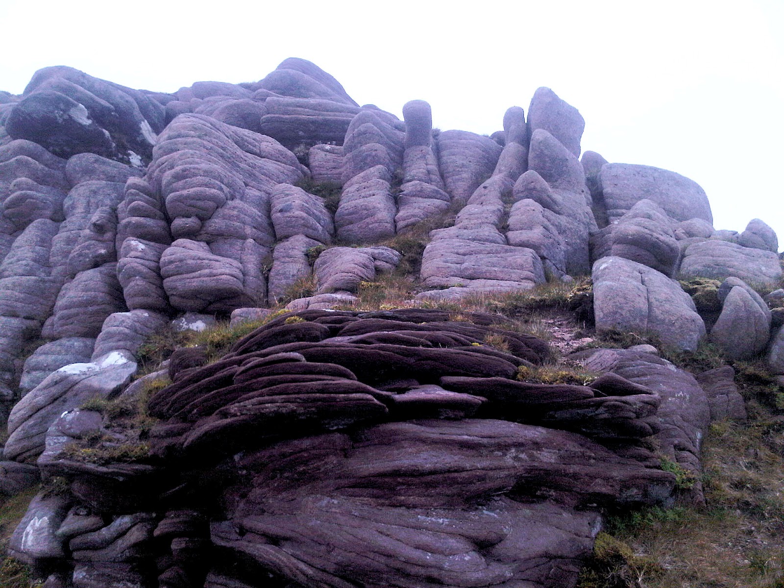
Every now and then we would stop to let the group bunch up, then head off again. Over the marshy area, using the stepping stones and onwards we strode until we began to reach the final steep parts near the summit.

Once upon the summit (974m) we waited shrouded in cloud for the rest of the group to arrive. One by one they all crept onto the summit, tapped on the trig point and then scouted around for a luncheon spot just out of the stiff westerly breeze. When the last had gone through this ritual, I decided that I had been stood on the summit for long enough and moved to make my descent. I'd have rather gone down the tourist track, just to keep the scenery changing, but the group had declared their intention to go back the way they had come, so reluctantly Mark, Alfie and I took that route too.


It turned out not so bad, on the way back down the sun poked through the clouds again and we were treated to those lovely Loch lomond views once more. At about half way down we met a group of four people going up, who asked... "are we nearly at the top?" We were tempted to joke and point to the western shoulder and say "yep, just a little bit to go" but instead chose to be more sadistic and inform them of the brutal truth.

Back at the carpark we quickly got out of wet boots and sweaty tees to smarten up and meet everyone as they poured into the post hike refresher that was the Rowardennan Hotel Bar. It might have just been an off-day for him, but we found the barman of this establishment quite grumpy. When ordering at the bar, you're told of the cost of your drinks and expected to hand over the cash before he starts  pouring anything. I wondered how this would pan out if I were choosing to use my visa card? Later as we sat in the conservatory dining area with our drinks, a few us heard a foreign guest ask the barman for the same again as he was clearing away an empty coke can from the man's table. He was given the reply... "aye, the bar's through there pal." Scottish hospitality at it's finest


Ben Vorlich, Arrochar - 28th Sep 2011


Pronunciation/Translation: Ben Vorlich - Byn Voarlick (Hill of the Bay)


When Shona and I climbed Ben Vorlich last autumn we attacked it from Ardlui and came back down the same way. I noticed that the guys from GHWC were planning on taking the Inveruglas ascent and Ardlui descent, I thought it would be nice to climb it again,this time from the other side.

Poor Alfie got left at home for this one, for two reasons really... car logistics between start and finish points, other folks aren't as keen to transport you back to your car with a muddy dog in tow. Also there was someone else taking their Boxer, and you can't always tell how the K9s are going to get along. Not to worry, Alfie has this one chalked up already anyway.


The start point for the walk was at the carpark just after the Inveruglas Power Station. Several of the group transferred their cars up to the Ardlui Hotel carpark where we were due to end the hike. Once all the motoring technicalities had been ironed out, we began the short walk along the road to the dam service track on the western side of the railway. The trail follows roughly the line of Inveruglas water all the way up to the dam wall at Loch Sloy. There are nice views to the west of Ben Vane, once you have passed the electrical pylon terminal on the left.


The weather was a bit mixed, reports had said it was going to be bright and sunny. Sadly, the clouds were proving slow to shift and it was still feeling quite cold and damp by the time we reached the Lag Dubh. It was here that we left the service track and began ascending steep and northeasterly to the col at just over 750m. Not long into this part of the route, two of the party and their dog decided to retreat back down to the service track and head back to the start. The rest of us plodded our way up the wet, grassy slope, finding traces of feint paths here and there.


By around 600m we were entering cloud cover. Not blindingly thick, but just enough to make navigating our way up that little bit trickier. At the col we turned right and made for the south peak  above Coire nan Each a short distance away. Here we could see all that were still ascending to the col, thus keeping the group together before pushing northwesterly up the ridge to Vorlich's main summit (943m).


A few minutes rest were had and some grabbed the obligatory bite to eat, but with the chilly temperature and fierce wind whipping over the summit ridge, the break was short lived. We moved on northwards and every now and then were treated to the sun breaking through the clouds. Eventually we dropped into full visibility again on the lower north slopes of the hill. Handy for us now to navigate around the crags guarding Coire Creagach. Once down past the trickier steep area we moved east then northeast onto easy gentle valley sides that drew us in the direction of Railway Cottage a little south of Ardlui.


With the finish line in sight everyone sauntered along fairly spread out and made it to the main road at various intervals. Not far up the road we all met up at the Ardlui Hotel and sorted out the end of hike car logistics before enjoying a refreshing Shandy in the bar.


Friday 16 March 2012

Ring of Steall - The Mamores - 19th Sep 2011


Pronunciation/Translation: An Gearanach - an gyeranach (the complainer), Stob Choire a' Chairn - stob corrie a cairn (peak of the corrie of the cairn), Am Bodach - am podach (the old man), Sgurr a' Mhaim - skor a vaim (peak of the large rounded hill).

(Entry by Shona)

From an overnight camp at Glen Etive, we wake to clouds and light rain. After packing up the tent, we head up to Fort William where we stock up on goodies for our hike.
We park the car at the Glen Nevis Lower Falls car park and get all of our gear sorted and feed the dogs before we start the long walk in to the Steall Falls.

Our walk takes us along the south side of the river. It’s pretty squelchy and wet but the path is good enough to follow. We wind our way along the riverbank and into some trees. From here, the path starts to climb along the edge of hill, and the going becomes a little rocky and uneven. We do a little climbing and scrambling before we come to a complete standstill. No idea where the path goes from here and we are perched on a little ledge with a high drop through trees to the river below.

We see a few people on the opposite bank and shout over to them to see if they can see the path on the other side. They tell us that there is a path farther along so we carefully pick our way across the rock face, and head up the hill where we join a proper path heading down to the Steall Meadows. The river is wide and shallow here. The meadows are flat and open ground surrounded by the mountains. We can see and hear the Steall Falls and head towards the mountaineering hut.


After a few snaps, we head towards the base of the water falls and eventually find a place to cross the water. The ground on this side of the falls is very boggy and we zig zag through various bogs to the higher ground. From here we head up in a steep ascent across the northern shoulder of An Gearanach. We meet a fellow hiker who tells of the weather from the summit. It’s not looking good and he has turned back. We decided to plod on regardless. Further up we cross paths with a few other hikers who have also decided to turn back. Again, we choose to head on up.


We put our waterproofs on as the rain has made an appearance. A little further up we start to feel the wind pick up. A quick discussion sees us heading for the summit to take a weather check from there. We summit An Gearanach (982m) and quickly move on as it is now pretty cold and windy. The ridge narrows here before it drops off the other side of the mountain and takes us up towards Stob Choire a' Chairn (981m). We stop here to look back where we descended before heading towards our next summit.


We get to the summit and carry on walking for a few minutes before we realise that we have followed the wrong path and are heading towards Na Gruagaichean. Um, that wouldn’t have been a good move. We head back towards the ridge and we are soon back on track and heading southwest towards Am Bodach (1032m).


The ascent is hard going, nearly vertical and the path zig zags tightly for what seems like an eternity. We eventually reach the summit cairn and stop for something to eat. We find a place which is relatively sheltered from the wind and stock up on energy for the remaining two peaks of the ring. Making sure we are still on the correct path, we head on to Sgor an lubhair. The ridge has narrowed here and the wind has picked up. Intermittent rain means the ground is soft and slippery so we are careful not to make any mistakes up here.


The dogs arent their usual spritely selves and are cold and wet. They choose the paths where there is less wind and stay close to us. We reach the next top and carry straight on through the mist towards the last Munro in the ring. The path crosses another track and Eric heads west. After a very loud shout to him followed with a hand signal, he sees that he is on the exit path. We head up the side of Sgurr a' Mhaim (1099m). It is very windy here with sheer drops on both sides of the ridge now.

Devils Ridge is the most dangerous place on this walk and it is not recommended in high winds. (like today!) We summit our last peak and do a quick check of the map as our route guide states we can walk off the north side, straight down to the car park. We decide that it isnt safe to go this way in thick mist and high winds, so we head back to where the  path crossed the earlier exit track.

Heading back along this part of the ridge was an interesting experience. The wind was severe and even the dogs were looking more than a little nervous. I got blown right off my feet here and was a little too close to the edge for comfort. We make it to the cross roads in one piece and head down a very good path, which takes us down to the Coire a' Mhusgain lochan. We have a quick map check and notice that someone has decided to camp next to the water.

As we head along the path, we go cross country and take a shortcut to where we want to be. From here the path is long and follows the girth of the mountainside, right round before dropping to meet the river. As we head down, the river drops down further and we follow the lower slopes until we can see Glen Nevis and then we see the car park. Another half hour and we are back the car.

As the dogs tuck into their treat of a pigs ear each, we sort our gear before heading back to Glasgow.

Time taken: 9 hours from 10.30am – 7.30pm.


Beinn Chabhair - Crianlarich - 8th Sep 2011


Pronunciation/Translation: Beinn Chabhair - byn chav-aar (hill of the hawk).

(Entry by Shona)

I had decided to do a short day at work and head for the hills, so after getting our gear together, we head north towards Crianlarich. Eric has his mind on Beinn Chabhair (933m/3061ft) , so we head up past Kilmahog and Loch Lubnaig and on towards Crianlarich. We pass Ben More and Stob Binnein and contemplate doing these 2 instead but a little confusion over the start point and where to park makes us decide to just stick with the plan.

We park the car at The Drovers inn and get all our kit together before heading along the road to Beinn Ghlas farm. We cut through the campsite and start the climb up through the bracken, along side the water fall. We reach the sheep fence but we make it over without too much incident although Bracken lost a few hairs in the process.


Short walk up and we walk straight out onto a lush green plateau. Stob Creag an Fhithich looms to our left as we follow the river onwards. The ground is boggy and peaty, so my feet get wet pretty quickly. yuck. I love my wee lightweight Merrells but they don’t keep the water out. We cross the river in a very exciting way……by jumping from one big rock straight over the water onto another. We manage to negotiate around and through the deep soggy bogs and make it to Lochan Beinn Chabhair.


From here we head north up to the shoulder and follow the path up and over various false summits/grassy and rocky outcrops. The wind is starting to pick up as we get higher so we up the pace and reach the summit cairn at 6.25pm. We put our jackets and gloves on as the wind-chill up here is fierce. Time for half a Wispa each and some photos before start our descent.


We cover ground fast and make good time. Treading carefully over some of the more unsteady and soggy ground means that we avoid any injuries, which is always a bonus.
The sun is setting in front of us as we follow the path down over the grassy outcrops back towards the lochan and everything begins to have a slightly orange and fuzzy look to it.
Although the plateau is relatively flat (considering our surroundings) the going is still pretty tough as the grounds sucks at our boots and poles. Im already wet and dirty so I don’t really try too hard to jump over the boggy bits, needless to say I end up knee deep in sludge a few times. My pole keeps getting stuck, which amuses Eric no end as I curse and mutter to myself.


We decide to stay on the north side of the river and follow the tracks down towards the water fall. Over the stile after showing the dogs the little gap for them, and we start heading down the side of the mountain with the falls on our left. The next stile is a little disconcerting as it leans down the hill. A strange experience to be leaning forward facing down a hill but we make it over okay and start the steep descent towards the farm.

We reach ground level at 8.15pm and put the dogs on the lead before we walk along the road back to the car. Soggy kit off and we settle the dogs in the car before we pop into the Drovers for a post hike drink.
From our start point at the farm to our end point was 11.83km, which is a pretty fair distance. and we did it in good time, so a good days  enjoyable hiking.


An Teallach, Wester Ross - August 2011


Pronunciation/Translation: An Teallach - an tyalach (the forge), Sgurr Fiona - skoor fee-ana (peak of wine), Bidein a' Ghlas Thuill - beetyan a ghas-hool (peak of the greenish-grey hollow).

(Entry by Shona)

Ullapool – 15 August 2011 to 18 August 2011

Monday 15 August

After a long morning or sorting out our gear and camping things, we start our long drive up the country towards Ullapool and the enticing mountains of An Teallach. We take a slight detour through Inverness and end up driving towards the West coast as dusk falls. Not a bad time to be driving as the mountains and surrounding hills look quite spectacular.


As we make our way along the A835, we catch our first glimpse of An Teallach. Wow. Jagged peaks rising from nearly nothing, the evening sun behind, casting them in dark shadow. We take some pictures from a distance and trundle onwards. As the road curves to the south, we are now within a mile or so of An Teallach and they feel as though they are looming above us, tempting us ever closer.

We turn off and head 7 miles along a single track road to the campsite at Badrallach.
We choose a small spot at the end of the site so that the dogs don’t disturb anyone, however we end up next to a family with 2 young children……..and I thought Bracken cried a lot!

We pitch the tent with near military precision and get our gear inside. The midges’ arent too bad but they are out there! We take the dogs down the path to the waters edge and admire the view across the water towards Dundonell. After a wee bite to eat we decide to have a whisky and get our heads down. Busy few days ahead.

Tuesday 16 August


We wake to rain and low cloud cover, so we have a lie in before we head up to Ullapool for the day. We drive leisurely along the roads and take in the scenery until we reach Ullapool. We walk round the town with the dogs and take a peek in all the wee shops. I still can’t seem to find the antlers that I want but Eric finds a nice Mammut hat.

We fill our tummies with some chips and have a drink in the terrace bar before we walk back to the car.Long drive back to Dundonnell where we head up past the other campsite at Badcaul. We both agree that the site we are on is better, even though it is a bit out of the way. Another fairly early night as we rest before our hike up to An Teallach tomorrow.

Wednesday 17 August


Up early, some noodles and hot dogs for breakfast. A hearty meal for any hiker and we pack up the car, dismantle the tent and drive round to the Corrie Hallie lay-by where we gear up, jump the stile and join the boggy path. We follow the stream on it's east side and head further up Coir' a' Ghiubhsachain onto the rocky outcrops which stretch out at the base of the An Teallach range. Little cairns mark the way as the path isn’t always clear. I can imagine how desolate it would be in winter.


As we hike further along towards Glas Mheall Liath, we plan which way we are going to head up and then we catch our first sight of Loch Toll an Lochain. Beautiful teal blue water glistens in the sunlight and we watch as two deer dart along the mountain slightly higher than we are. We are now in a mix of boulderfield and scree and we make our way up the steep side, stopping for pictures and to enjoy the surrounding views. The midges make sure we don’t stand still for long though and before we know it we have reached the summit cairn of the first of the days peaks.


From here we head south towards Bidein a' Ghlas Thuill (1062m), the first of 2 Munros on the range. We walk over what we think are slight mounds of rocks but they end suddenly and have massive drop offs. Could be very dangerous in mist or snow or just general cloud cover. After a few detours to avoid the rocky outcrops, we ascend up to the summit, We don’t see much as we are now inside a cloud.


Quick snack before we ‘glove up’ and start the descent. We drop down below the clouds and onto the ridge between Bidein a' Ghlas Thuill and Sgurr Fiona 1060m, the second Munro on the range. As we get out of the clouds, we can see along to the coast and see all the little islands. Pictures just can’t pick up the same detail. It is amazing.


We pass a few people on the ridge, who don’t say much and look pretty tired.
From this part of the ridge, we can look right down into the corrie and take in the full size of the lochan below. The whole corrie is made of steep slopes with triangular peaks and zigzags cut into the rock. It’s like the Cuillin on Skye but with more greenery!
The best corrie and lochan in Britain? I can see why. It’s breathtaking up here.


We push on and wind our way up and around the peak of Sgurr Fiona and spot a few sheep grazing, just above is shrouded in cloud. Not a sight I expected, I have to say. Eventually we find the summit cairn. Back up in the clouds again.


We drop off the north east side of Sgurr Fiona and head towards the Corrag Bhuidhe. 
From here, the path skirts the edge of the ridge with sheer cliffs which fall right down to the lochan below. We look out over Fisherfields and the surrounding mountains that stretch for miles.


As we take pictures of the huge jagged peaks of Lord Berkeley’s Seat, we see a man right at the top. Eric shouts up to him and takes his picture. But it’s hard to get the full scale of the drop into the picture.


We circle round the lower part and meet the guy and have a chat. Eric sends him the picture to his mobile. After a pleasant chat we bid each other farewell.
From here the terrain changes and we are on a very steep and narrow path with slight climbing to be done. We take our time and make sure the dogs are okay and then we catch our first glimpse of the wild mountain goats. They have the most beautiful coats and we watch as two young males tap horns right on the edge of the rocks. Hardy little blighters. They’d have to be in this place! They decide that we are too close and they skip off further up the mountain where they stand and watch us from a distance.


The last two peaks are easy climbs and we make good time on these. We decide to head off the end of Sail Liath, which is boulderfield and soggy heather. The rain has found us and we go slowly. These boulders are ankle breakers. Each stone varies between the size of a small tv and a small family car! We make it down off the boulders and are soon being attacked by the ever present midges. Argh!

 
We still have a way to go before we pick up the path to Corrie Halle and we trudge on.
I slip on some slimy rocks and end up with a hand full of mud! I shout back to Eric to take care on the rocks, but he has the same spill as me and ends up with peaty mud all up his sleeve! Ooooops. We stop at a wee stream so that the dogs can have a well deserved drink and Eric cleans off his jacket.

 
We trudge across the path and look back over the peaks of An Teallach, which is now my favourite place and favourite hike yet! We pick up the old military track and follow it for what seems like an eternity but we have good pace and make good time. As we walk through the forest of birch trees, a small flock of sheep appear from the bracken and bolt across the path. Eek!
We finally reach the road, lead up the dogs and walk back towards the lay-by, where the car is parked. Dogs in the back and gear off, we drive round to Ullapool for the night.

We pitch on the shoreline right at the end of the Broomfield Caravan Park and walk back into town. We try to eat our dinner and enjoy the evening but the midges are relentless! I give myself bad indigestion and end up a little green around the gills. We walk along to the Ferry Boat Inn and they say that we can bring the dogs in after meals have ended in 20 mins, so we do a couple of circuits of the lower part of town before enjoying out post walk pint and a look through the photos.

Eric has taken some amazing pictures. More than he normally does, which is a good thing though as my BB got a drenching on Glen Shiel Ridge last week and my spare phone ran out of battery after the first mountain on An Teallach. We finish our drinks and walk back to the tent. We fall asleep listening to the water lap the shore.

Thursday 18 August

Up early and we pack up the tent and head through Ullapool and back down towards Drumnadrochit. We decide to stop a little further down in Fort Augustus for lunch and a stretch of the legs. I take over the driving and batter down the road. As we head through Glen Coe, a fighter jet rips through the sky line with an almighty woosh.

We make good time and are back at Eric's before we know it. Eric spends the evening sorting through the pictures and getting them all cleared up. We enjoy looking back through them and both agree that An Teallach is one of the best hikes we have done. I enjoyed every second of it and would like to go back but maybe to do the mountains of Fisherfield with a wild camp next to the loch on the east side of An Teallach…  …see the range from another angle.